University of Louisiana at Lafayette researchers are developing a way to streamline information sharing related to hurricanes, tornadoes, terrorist attacks, chemical spills and other large-scale disasters.
“The Louisiana All-Hazard Information Portal will improve data collection efforts to enhance the State of Louisiana’s ability to quantify and communicate all-hazard risk. No such platform currently exists. The quantification of risk will enable disaster management officials to better understand the risks that various communities face, and also to educate the general public and businesses in an effort to enhance the community’s all-hazards disaster resiliency and community sustainability,” said Dr. Ramesh Kolluru, interim vice president for Research at the University of Louisiana at Lafayette.
The issue, which gained international attention during Hurricane Katrina, persists for one reason, Kolluru said: “Every agency speaks a different language, uses different terminology, and has different plans. It causes confusion and ineffectiveness.”
In the wake of Hurricanes Katrina and Rita, the National Incident Management Systems and Advanced Technologies Institute was launched in 2007. The University’s homeland security and emergency management center provides research, outreach and technology for emergency preparedness and disaster recovery.
Or, as Kolluru, the institute’s founding director puts it, “to help save lives and minimize economic devastation.”
The Governor’s Office of Homeland Security and Emergency Preparedness recently awarded NIMSAT a $1.3 million grant to fund an ongoing project to do just that.
NIMSAT is developing technology capable of being used nationwide for more efficient storage and dissemination of disaster-related information. “The objective is to build a repository containing accurate, uniform data that can be updated and used before, during and after a disaster for Louisiana,” Kolluru said. “Once complete, other states would have the ability to use the system to enter its threat, vulnerability and consequence data for their own disaster informatics repository.”
NIMSAT is creating the Web-based application based on a format recognized by the U.S. Department of Homeland Security and Federal Emergency Management Agency. It will contain information that includes:
• historical data about weather trends and natural disasters;
• demographic and economic profiles of disaster-prone areas; and
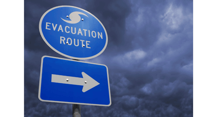
• maps showing evacuation routes.
The system will be designed for use in situations other than the midst of a crisis, said Dr. Raju Gottumukkala, NIMSAT director of research. “It will be for everything from building codes to helping the ‘average Joe’ decide if he needs to build his house on stilts.”
Current NIMSAT work on the project includes creating demographic and economic “risk assessment profiles” of different regions of the state.
That involves combining FEMA data accrued since 1953 with information gathered from other federal agencies and local governments.
Once complete, the system, which is being outfitted with Louisiana-specific information initially, will have the capability for being tailored to other regions and many types of disasters.
“The goal is to build an effective tool for Louisiana that can also assist local communities with their respective hazard mitigation, continuity of operations and other planning efforts on a national scale. Since the Gulf Coast is so prone to events like hurricanes and other natural disasters, it makes sense that we should take the lead in coming up with such a system,” said Clay Rives, NIMSAT associate director.
NIMSAT recently assisted with FEMA’s Superstorm Sandy recovery efforts. The storm, which struck the Eastern Seaboard last October, killed more than 250 people in seven countries, and caused billions of dollars in damage.
The institute collaborated with Google Crisis Response to map the locations of open gas stations, pharmacies, grocery stores and other retail outlets. “We provided operational support to make critical information more accessible during the disaster,” said Rives. “We have a group of experienced emergency management and homeland security practitioners and academic researchers at UL Lafayette. We are providing research-driven best-practice solutions at the NIMSAT Institute. The Louisiana All-Hazard Information Portal is just another real-world solution.”
NIMSAT researchers also collected data in advance of Hurricane Isaac, which struck the Gulf Coast in August of 2012, to give gas station owners, bulk suppliers and transporters a window into area fuel needs.
For more information about NIMSAT, visit www.nimsat.org.