Two researchers at the University of Louisiana at Lafayette are contributors to an atlas focused on coastal Louisiana’s complicated – and at times, hazardous – relationship with geology.
But don’t be fooled by the name. The Louisiana Coastal Geohazards Atlas is more than a collection of maps. It’s an encyclopedia, too.
It will combine information about geologic conditions – such as flooding, faulting and subsidence that can affect land use in the coastal zones – into a first-of-its-kind authoritative resource.
Other coastal states have similar atlases. Louisiana does not, said Dr. Gary Kinsland, a professor in UL Lafayette’s School of Geosciences.
He, assistant geosciences professor Dr. Raphael Gottardi and researchers from other state institutions are collaborating on the atlas’ 20,000-word section dedicated to faults.
Faulting occurs in south Louisiana when sediment layers fail, Kinsland said.
“The failure is similar to faults in the upper layer of a layer cake if you put it down on the frosting covering the lower layer while the layers are still warm. The frosting, if warm, is very weak, as are particular deep layers of sediment in the Gulf, and the top layer – whether cake or sediments upon which we live – breaks and slides down and away.”
Movement between the sediment layers can cause visible cracks or sinking at the surface, so awareness of faults is important when building homes, constructing infrastructure or drilling for oil.
“Civilization exists by geologic consent,” Kinsland said, borrowing a phrase from philosopher Will Durant. “The earth little cares what human beings do. Human beings, for their own good, have to pay attention to what the earth does.
“When you combine humans, human society, human culture, with geology, then there are things about the way the earth operates that are geohazards.”
Sections of the atlas will also consider flooding and subsidence, the compaction of sediment that causes a gradual sinking of coastal land into the ocean. It’s a major contributor to the decrease in coastal wetlands.
The sources of these problems, and their consequences, are not confined to parishes that touch the Gulf of Mexico, Kinsland said.
With its web of bayous, rivers and other interconnected waterways, all coursing toward the Gulf, what happens upstream has implications hundreds of miles away, and what happens along the coast can cause problems upstream as well.
So the atlas will explore geohazards south of the Lower Crustaceous Shelf Edge, which arcs from St. Bernard Parish in the eastern edge of the state upward toward Vernon Parish in central Louisiana.
That puts all or part of 35 Louisiana parishes – and nearly three-quarters of the state’s population – in a coastal zone, making the atlas an important tool for builders, oil and gas companies, attorneys, government officials and the public, Kinsland said.
The atlas will contain information that’s been available previously from scholarly journals, industry publications, conference papers and various geological societies in the state and Gulf Coast.
“Our end goal is to put in one place an authoritative source for people to refer to for the hazards in the coastal zone, and let them know why they’re happening, the rate at which they are happening, and the geological causes that are leading to them so people understand what you can and what you cannot do to avoid the damage from the hazard,” Kinsland said.
“It just sometimes blows me away when people think geology is static. Geology is not static anywhere, and there are few places on this earth where the geology changes as rapidly as the coastal zone of Louisiana.”
Researchers from the University of New Orleans, LSU in Baton Rouge, Tulane University and the Louisiana Geological Survey are also contributing to the atlas.
The LGS is the state’s leading geological research institution. It will direct the project in collaboration with the New Orleans Geological Society.
Dr. Charles Groat, LGS’ acting director, said the atlas “will serve as a valuable resource for the state and the region.
“While much work has been done to better understand these processes, the results have not been compiled and combined in a format that brings them together to portray the influences on the coastal plain of south Louisiana.”
The atlas’ anticipated publication date is next year.
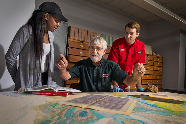
Photo caption: Dr. Gary Kinsland, a professor in UL Lafayette’s School of Geosciences, explains geohazards in Louisiana’s coastal zones to students Nicole Bartley and Robert Narmour. (Photo credit: Doug Dugas / University of Louisiana at Lafayette)