An effort to reduce flood risks and improve floodplain management is getting a boost from researchers at the University of Louisiana at Lafayette.
Researchers at UL Lafayette, Tulane University and a range of state and federal agencies are informing a six-year, $15 million project to install 100 rain and river gauges and 15 water quality sensors across Louisiana.
The project is part of a scientific modeling program being overseen by the Louisiana Watershed Initiative and the U.S. Geological Survey. Gov. John Bel Edwards created LWI in 2018 in response to unprecedented flooding in 2016 that inundated 56 of 64 parishes, killed 13 people and caused billions of dollars in damage.
As part of the initiative, local, state and federal agencies are collaborating to improve Louisiana’s flood assessment and mitigation practices and policies.
Researchers from UL Lafayette’s College of Engineering and the University’s Louisiana Watershed Flood Center assisted in the development of a geospatial design for the statewide network.
“The design process started with the launch of crowdsourcing web apps to gather input from stakeholders across the state who provided close to 700 suggestions for new gauge sites,” said UL Lafayette’s Dr. Emad Habib, a professor of civil engineering who directs the Louisiana Watershed Flood Center.
“The UL Lafayette research team, in collaboration with state and federal agencies, developed a geospatial optimization methodology to strategically prioritize the locations of the new gauges. A final network design was produced and delivered for final site investigation and implementation by the U.S. Geological Survey,” he added.
The system will provide consistent, accurate data about rainfall amounts, river levels and water flow rates that will help hydrologists develop scientific models that paint a comprehensive picture of where water flows and in what amounts.
Data from the new sensors will also be funneled into a publicly-accessible dashboard “that will provide real-time information to community leaders and emergency management officials,” Habib explained.
“The ability to monitor rivers and waterways will fill critical gaps in our understanding of how water moves across the state. Once complete, the gauge monitoring system will help public officials with everything from making determinations about evacuation plans to establishing long-term watershed and water management plans,” he added.
Learn more about the Louisiana Watershed Initiative modeling program. View an interactive map of the new gauge network.
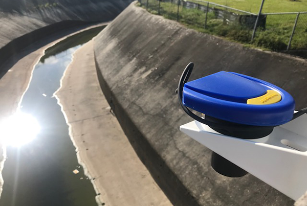
Photo caption: As part of the Louisiana Watershed Initiative’s scientific modeling program, UL Lafayette researchers are collaborating on a project to develop and install a network of river gauges (similar to the one shown above), rain gauges and water quality sensors across the state. Photo credit: University of Louisiana at Lafayette